Our Projects
Discover the impact of Pacific Tech Systems' work through our featured projects.
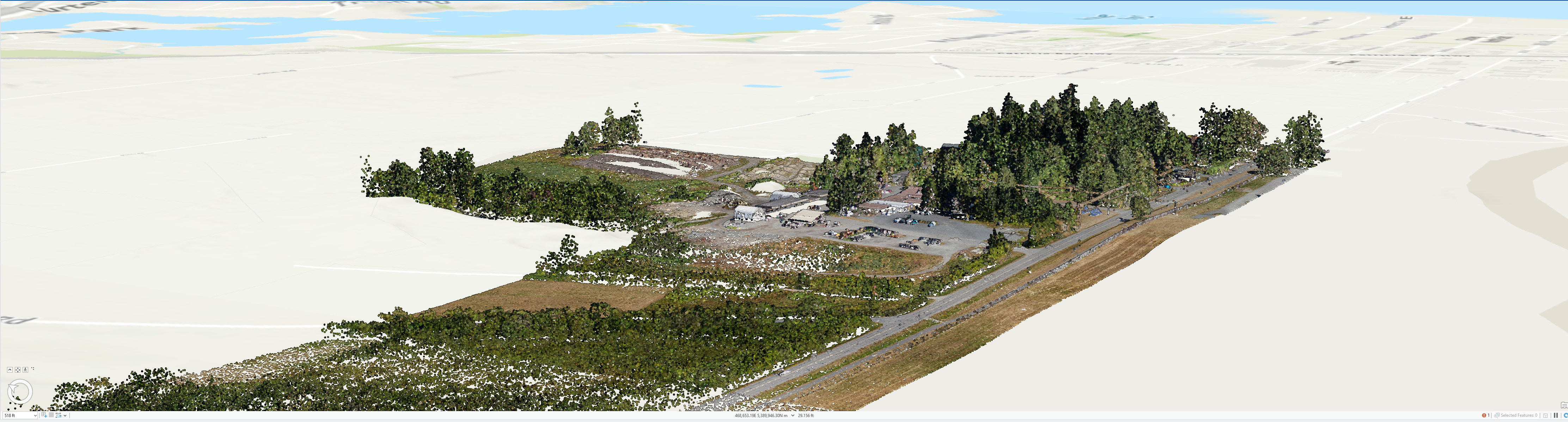
LiDAR Data processing and DEM Generation
Client:District of North Saanich
This project involved the meticulous processing of raw LiDAR data sourced from government agencies. Key steps included quality assurance for data completeness and resolution, noise filtering, and precise classification of ground and non-ground points. From this enhanced data, a high-resolution Digital Elevation Model (DEM) was generated, followed by rigorous accuracy validation against known control points and reference datasets.
Outcome:
- The result was a highly accurate and validated Digital Elevation Model, providing the client with a foundational dataset critical for detailed terrain analysis, infrastructure planning, and informed environmental management decisions.
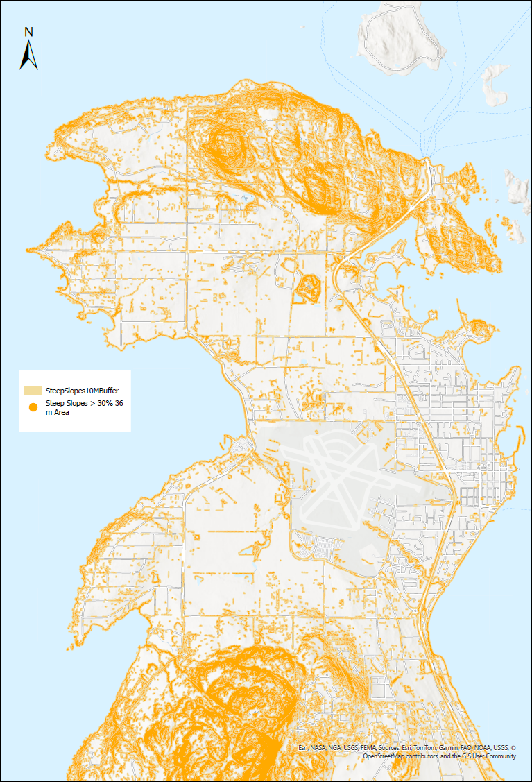
Steep Slope Map Production
Client:District of North Saanich
Leveraging the generated Digital Elevation Model, this project focused on comprehensive slope analysis. Slope gradients were computed using advanced GIS algorithms, and then classified into distinct categories (e.g., moderate, steep, very steep) to identify areas of potential concern. This analysis formed the basis for producing detailed steep slope maps to high cartographic standards.
Outcome:
- Delivered professionally designed steep slope maps in various industry-standard digital and print-ready formats (including PDF, GeoTIFF, and Shapefiles). These maps serve as crucial tools for the client, enabling effective land-use planning, risk assessment for development, and the implementation of appropriate safety and environmental protection measures in high-risk slope areas.
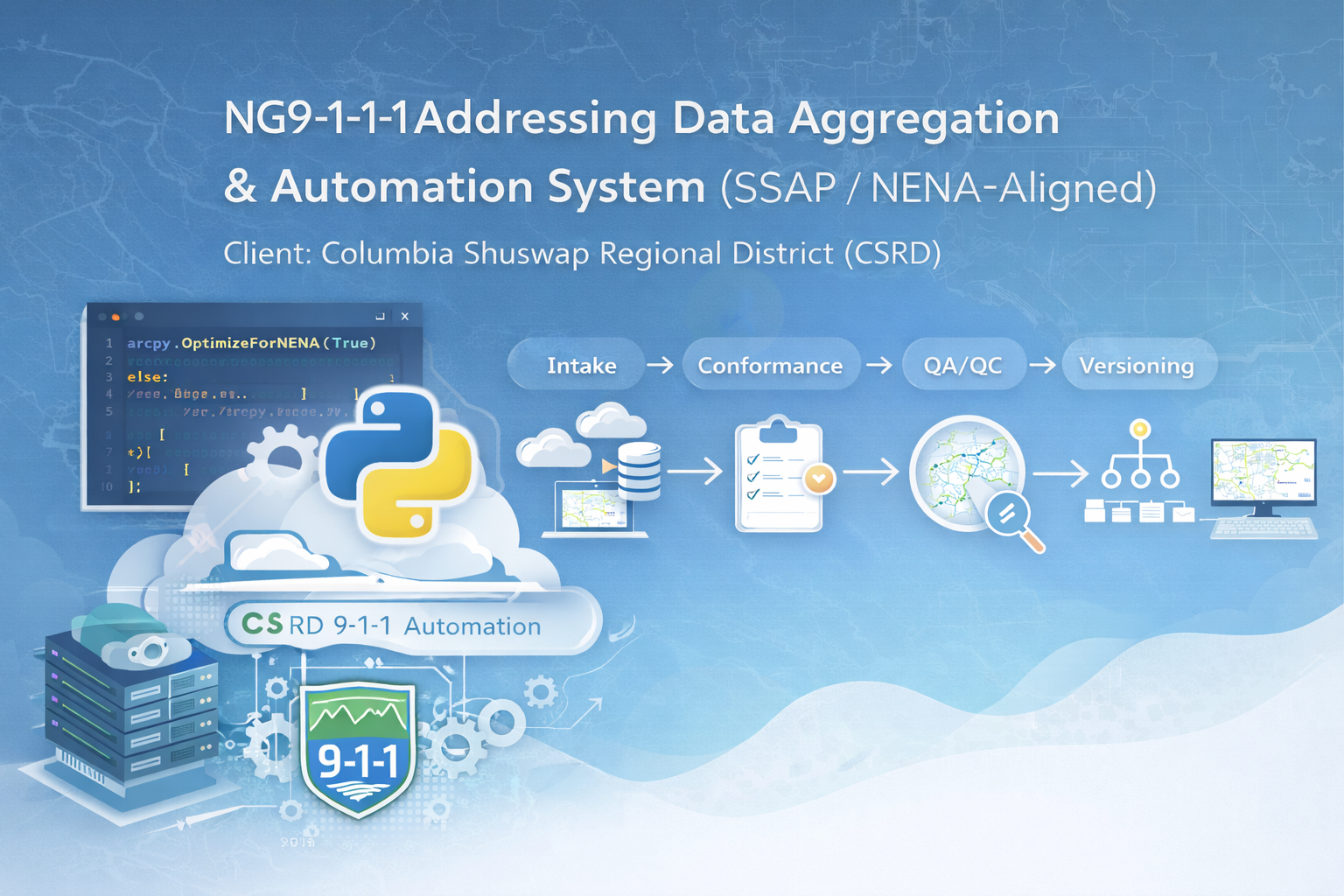
NG9-1-1 Addressing Data Aggregation & Automation System (SSAP / NENA-Aligned)
Client:Columbia Shuswap Regional District (CSRD)
This project delivers an automated addressing data aggregation system for CSRD and its member municipalities to support NG-9-1-1 readiness. The solution centralizes multi-jurisdictional addressing and road updates into a standardized SSAP environment aligned with NENA requirements, enabling consistent intake, validation, and publishing across diverse municipal workflows. The end-to-end system was intentionally designed to accommodate CSRD’s existing software infrastructure to ensure long-term compatibility, streamlined maintenance, and minimal disruption to established GIS operations. The workflow supports multiple submission methods (web editing and structured file-based updates) and applies automated conformance, QA/QC checks, and change tracking to ensure completeness, schema compliance, and reliable, repeatable update cycles. A traditional versioning approach (DEFAULT / QA / municipality editor versions) provides controlled review and staged promotion of edits prior to release.
Outcome:
- Standardizes and consolidates municipal addressing data into a centralized SSAP dataset
- Automates QA/QC, reporting, and audit logging to reduce manual effort and improve consistency
- Enables controlled staging through QA before publishing authoritative updates
- Produces validated deliverables in industry-standard formats (including File Geodatabase and related GIS outputs) for downstream distribution and NG-1-1 implementation readiness
- Aligns with existing CSRD infrastructure to simplify ongoing support and maintenance
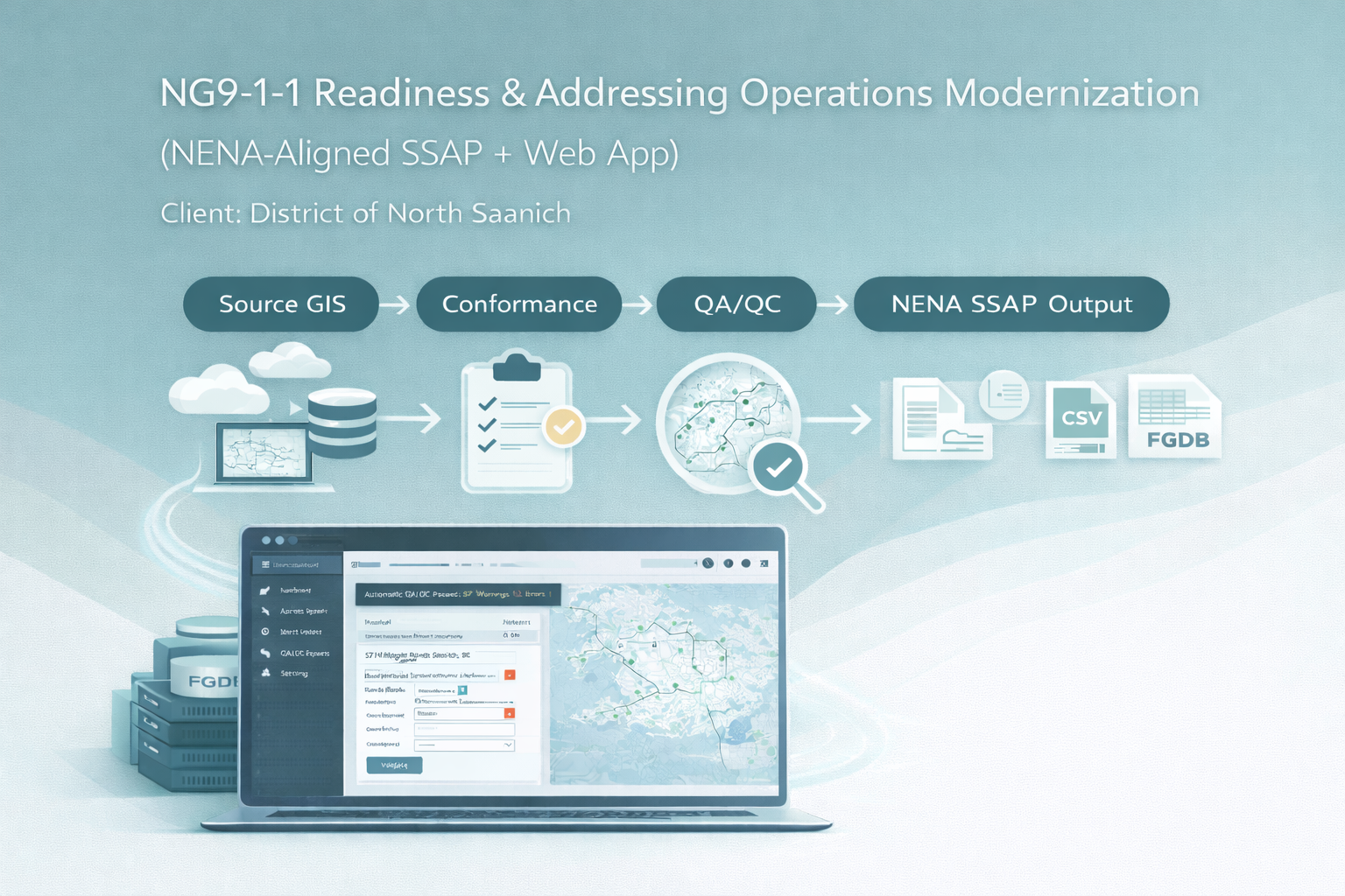
NG9-1-1 Readiness & Addressing Operations Modernization (NENA-Aligned SSAP + Web App)
Client:District of North Saanich
This project delivered an NG9-1-1 readiness framework for the District of North Saanich by standardizing and preparing core GIS layers—address points, road centerlines, and related emergency response attributes—into a NENA-aligned SSAP dataset. The work focused on creating a reliable, repeatable pathway from municipal source data to NG-9-1-1-ready deliverables through structured conformance rules, schema alignment, and quality validation. To further modernize day-to-day addressing workflows, a web application was developed to automate and streamline addressing data operations—supporting consistent updates, reducing manual processing, and improving operational visibility for staff. The overall solution was designed to integrate with the District’s existing GIS environment to ensure long-term compatibility, streamlined maintenance, and clear operational ownership. Automated QA/QC checks and reporting were incorporated to reduce review time and support ongoing updates as municipal addressing evolves.
Outcome:
- Aligns municipal addressing and road data to NENA SSAP requirements for emergency communications readiness
- Automates conformance, validation, and QA/QC reporting to improve completeness and consistency
- Provides a web-based workflow to streamline addressing data intake, updates, and standardization
- Produces standardized, submission-ready GIS deliverables (e.g., File Geodatabase and common GIS export formats)
- Establishes a repeatable update process that supports long-term maintenance and future expansion